back up to https://onebubble.earth
Lundy Island training expedition
Tuesday, May 19, 2015 - 13:12
Before I'd committed to round Britain I'd been planning a bit of an adventure with my brother Gregg and mutual friend Ian Leonard (ex-Boards Magazine Test Editor). Ian lives in North Devon and has had Lundy Island tempting him to make the crossing for longer than he cares to admit to, so was very keen to tick that box. For me it seemed like a great challenge and now that I am committed to round Britain a very useful training sail. For Gregg - well - it seemed easier than life at home with a 3 and a 1 year old...
We'd given ourselves a less than generous weather window of 2 days so less-than-perfect conditions could have been expected. As it turns out on day 1 we arrived late and there wasn't much wind, which left the only possible departure as early on Saturday 17th May.
Early arrived and we jumped in the van to make for our start point at Bideford. Van battery was flat, so we hurredly changed van. We drove to Bideford for 6:30am and found the gate to the beach locked. Early turned into not quite as early as we'd have liked, but there was certainly wind.
We started in the estuary at Bideford, Gregg and Ian hitting the water before me and doing a few runs in the river. Gregg's beating straps pulled out and to be honest he didn't sound or look 100% in terms of health, plus the conditions were looking towards the iffy side of doable. I headed out and went to chat with Gregg. It was agreed that Ian ("conditions look fine") and I would head out. I wasn't sure it was the right day for a Lundy crossing, but it seemed a sensible time to go out and get some west coast experience, so out of the estuary we headed.
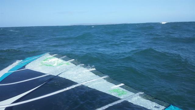
Lundy wasn't visible in the overcast conditions but was 20 miles NW from our start point, dead upwind. The wind was in the 15-20 knot range and the sea pretty lumpy. I'm pretty sure the estuary start was a good call as getting off from the Westward Ho! beach would have been tricky to say the least in my opinion (Ian reckons it would have been fine though).
We tracked north - occasionally tacking - for about 8 miles in conditions that were becoming increasingly lumpy. Our plan being to push up past Woolacombe to where the ebbing tide flows more rapidly out of the Bristol channel, and we would more quickly make toward Lundy once in this stream. As it turned out the wind over tide conditions were creating a difficult seastate so we didn't push quite as far north as originally planned, instead heading west on the first true leg towards Lundy, which was now visible in the improving visibility.
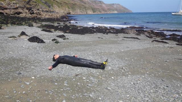
Sailing in these conditions definitely required 2 hands on the boom. So my intentions of checking the GPS and taking a few pictures went out the window. Plenty of food for thought for my round Britain preparations. It took me about 5 attempts just to check the time on my watch!
I'd been letting Ian judge where to tack (in Ian's case fall in) and after a really very long leg in mostly the right direction Ian took his next tack as an opportunity for a break, and as the sea was now a bit calmer I followed suit. Progress seemed good but we were still a long way out and I reminded myself that with this wind, and the strong tides, we really weren't in a safe place until our feet were planted on Lundy terra firma. With our sails down we weren't visible to each other either, having become separated on the long leg west.
Ian got going again and after some faffing about I followed suit, now playing catch up. A fishing boat came into view, and then faded out of view behind us. As we got closer to Lundy we started to see more seabirds. It was disorientating having lost the reference points of the mainland and to quite a large extent my navigation was reliant upon the wind direction having not changed. I wasn't quite sure which part of Lundy coast was which - perhaps we'd got swept further down and I was looking at the island from the south rather than the west? Another note to self was made to get a decent compass sorted.
I'd got closer to Ian now and forced the final tack (note the layline on the GPS track- quite proud of that!).
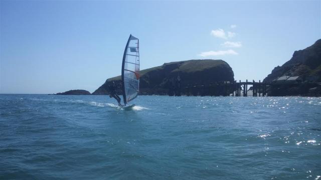
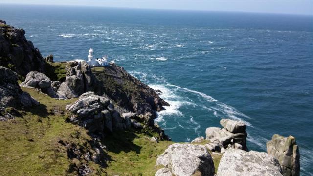
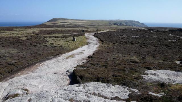
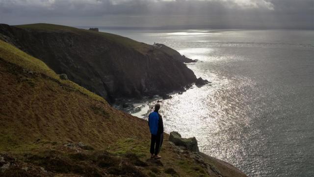
Lundy took a long time to get bigger; but what a beautiful sight as we started to make out the detail of the lighthouses, then the masts of a moored yacht and a track winding up the cliff side from the beach - our landing spot - nestled in the southeast corner.
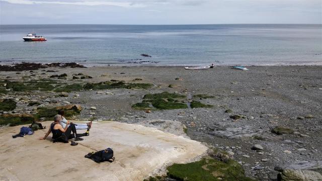
Ian was pretty shattered by this point it turns out, and when I asked him to slow down for a pre-landing photo he wasn't very impressed (I later found out). He slowed down and fell in which wasn't really what I, or he, was after. The tide was threatening to sweep us round the southern tip of the island which wouldn't have been great. Fortunately after a bit of faffing he sorted himself out and we made it to the beach. Big smiles!
In truth I am very impressed by Ian's stamina and no-nonsense attitude on this sail. The sum total of his training had been a 20 minute sail on the estuary the week before our expedition. I'd lent him a board (a 20 year old Mistral IMCO) and the sail was a 50 quid Ebay special, that Gregg had lent him. I'd also insisted he leave his (30 year old?) Rotho 480 epoxy mast at home and lent him a nice new Tushingham 100% carbon. He did have a wetsuit and harness at least. Very well done Mr Leonard - I doff my hat to you.
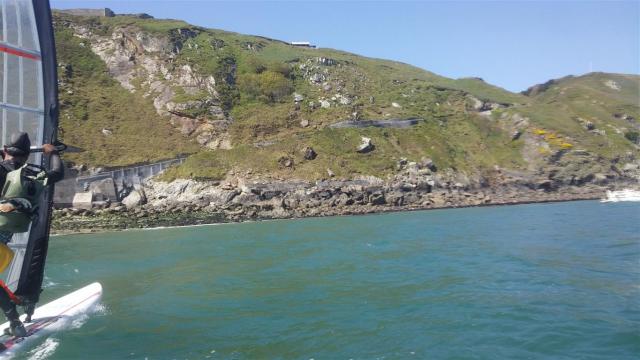
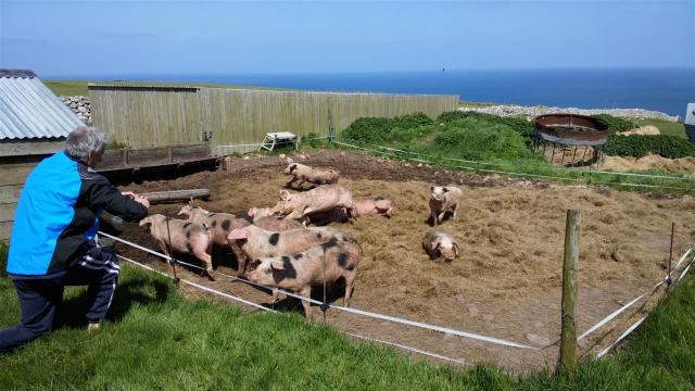
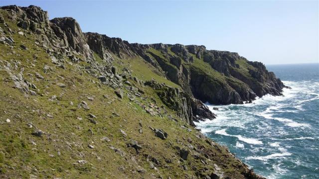
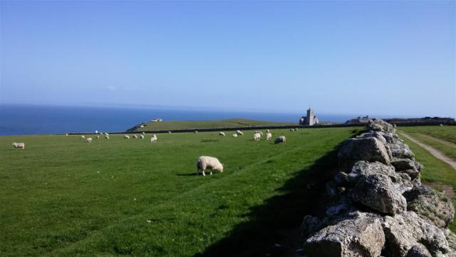
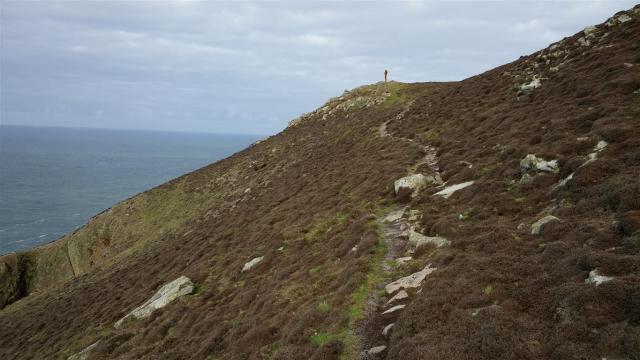
We were given a very warm welcome by the Lundy islanders, particularly Emily and Mike who couldn't have been kinder. The island is beautiful. There is a variety of managed and farmed animals (soay sheep, highland cattle, goats, deer, pigs), and many bird species. The island is about 3 miles long and we made the walk to the north end (it turns out Ian wasn't that keen on this either - something or other about flip flops?). The tidal race at the north end was noteworthy. It was a glorious day.
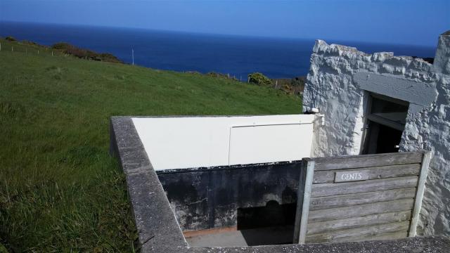
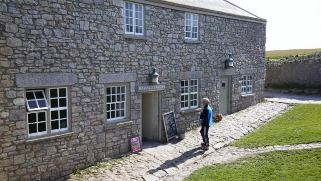
We returned to the pub, where we stayed until we couldn't stay awake any longer, and were asleep before nightfall (we made it to the campsite). The pub is also noteworthy. It serves excellent food and beer and has perhaps the most picturesque view from any urinal in the country.
Next day dawned windless but some texting to our meteorological control centre (Gregg) suggested that by midday there should be some wind. We prepared with a morning stroll followed by a full English breakfast.
The sail back was uneventful and easy - a twenty mile broad reach to Bucks Mills (Ian's local "secret" fishing spot - rubbish for fishing by the way, not worth bothering with). The wind picked up about 5 miles in to the journey and there was just enough to plane after that, and some pleasant rounded swells to catch.
Our weather man met us at Bucks and was feeling sufficiently recovered to help us walk our boards up the cliff to the car park. He'd also got the van going (thank you Gregg).
All in all a thoroughly excellent expedition, and lots to think about before my departure next month.
Lundy notes
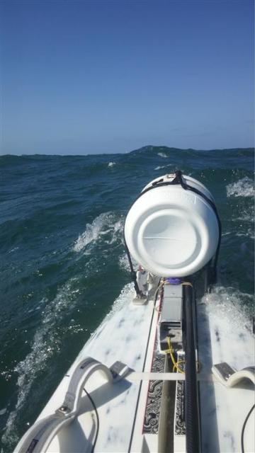
I sailed in expedition trim - with a fully loaded barrel and Aquapac drybag backpack.
Luggage included:
- Standard Horizon handheld VHF
- ACR Personal Locator Beacon
- Vibram Fivefingers shoes (very comfortable for sailing and for walking)
- Mobile Solar Chargers powerbank (for Lundy phone recharging)
- Sleeping bag, inflatable mat, bivvy bag.
- Gel enery bars
- Food
- Some warmer clothes
- Sun block
- Waterproof headtorch
- Meths, beer can stove, cooking pot
- Water.
- Paddleboard paddle
- A few other bits and pieces.
My Gul drysuit kept me warm (much warmer than Ian), and Prolimit harness was nice and comfortable.
Outward track
Return track
Can be viewed here.